A Cataclysmic Flood
Produced in 2018 for the Yale undergraduate architecture course Urban Lab: City Making.
My transect between the West and the Mill rivers is split into four versions separated by season and year. The first iteration takes place in the initial spring of the flooding, and New Haven is not entirely flooded. The more opaque the blue, the higher the water level in the area. Because the industrial eastern side of New Haven has more impermeable surfaces, the flood effects are more extreme there. The next map shows summer conditions two years later. Here, the rivers have completely flooded the areas, with the areas closer to the rivers having the highest water level. This map also features a green layer, to portray the algae blooms that occur due to the contamination of the water. The third map portrays an autumn scene in the fifth year after the flood. We begin to see some significant development, some of it corresponding to the city program from before the flood, like the Yale School of Medicine, and some of it mostly ignoring the structures below water. In the residential neighborhood, communal facility spots begin to pop up, and the houseboats that people now live in (not pictured) dock nearby. The industrial area is not developed because of the health risk, as much of the zone dealt with trash. In the fourth transect, winter twenty years after the flooding is depicted. Because of the snowy weather, there is a light white layer to indicate ice and snow covering the water. There is more infrastructure, though much of it is below and in the more central part of the city. The highways have been repurposed as a barrier against rising sea levels. Together, the transects show a fragmented year, and the progression of a city in disaster.
Sections
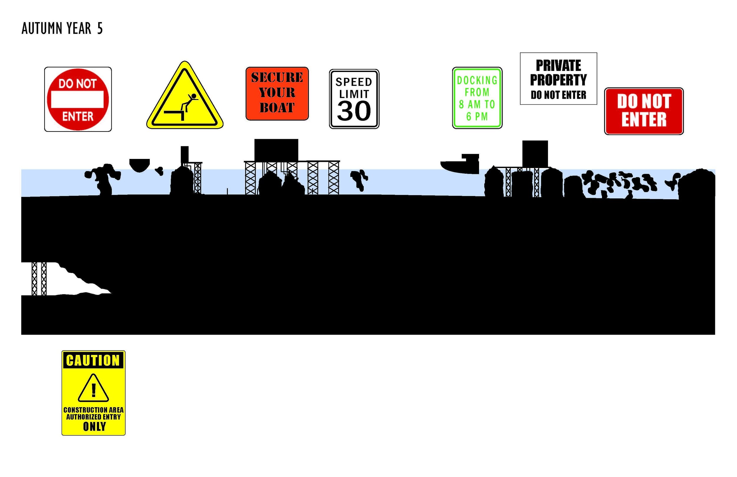
My macro sections depict the adaptations undertaken by a residential neighborhood to accommodate the changing environmental conditions. In the beginning, the city attempts to cope with the flooding. During the first spring of the year, the citizens have evacuated and have left behind their property. The signs that remain are indicative of the initial responses of New Haven residents to the flood, but of the inadequacy of these first efforts to claim the town from the flood. In the summer, New Haven has had some construction, and is in the process of creating the infrastructure necessary to re-establish the city. We see the algae bloom, the safety concerns of the citizens, and their humor and resilience. By Autumn, we see much progress has been made. An underground subway system is beginning construction, and the community has began to rebuild socially while establishing its roots in the new environment, through community sponsored agriculture for aquatic sustenance. Finally, in the last panel, we see that New Haven has become more urbanized. There is a metro, there is much more infrastructure, and there is even graffiti on the new construction. Yale, like the rest of New Haven, has also refused to give up its hold on the city, and is now in the process of expanding its domain, hence the blue light system emergency sign. Through my protagonist, the signs, these sections tell the story of New Haven by the traces and directions left by citizens. While humans are not explicitly featured in this narrative, their presence is felt, and their resilience is celebrated.


